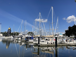
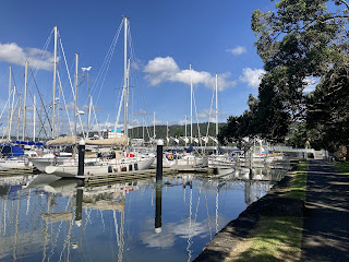
Hello! All is well here in Whangārei where we are in tucked into the best berth Town Basin Marina.
And we are waiting for a big blow thanks to Cyclone Gabrielle, now lurking in the Coral Sea off the West Coast of Australia. It looks like it will be passing fairly close to the east coast of the Upper North of the North Island. It had been forecast as a direct hit to the Upper Northland, but every day the track seems to be moving further to the East, offshore of our location. A big High Pressure to the southeast of New Zealand had been keeping Gabrielle tracking toward south but as it moves further southeast so does Gabrielle.
It is a big system though and will bring lots rain and strong winds to much of the North Island. According to the last forecast we are expecting periods of wind speeds between 20 to 30 knots with the potential for gusts up to 50 knots. Days ago the forecast was suggested gusts up to 70 knots so things are definitely going in the right direction.
We don’t really expect anything like that where we are. We are the red arrow near the top left of the screenshot.
Most of the concern about this storm is for Auckland and the Coromandel Peninsula. These areas have taken a beating in the last few weeks and we are expecting a lot of rain.
Having said all this, there are still several days before the system will reach us and the weather models will become more accurate as it approaches.
While we wait, we aren’t taking anything for granted and are erring in the side of caution. I’ve been found some useful sites regarding cyclone preparedness. This was my favourite - 18 Steps to Prepare for this Cyclone Season. We won’t have anything like cyclone force winds but it’s good practice and makes you better prepared to respond to a really big blow.
Today and for the first half of tomorrow (Saturday) we are having hot dry weather. Which is just as well as we can expect varying amounts of wind and rain until Tuesday or Wednesday.
The three day forecasts are quite accurate but anything after that is subject to change. Right now the system is heading southeast, which is the right direction.
I’m posting this now just so as not to worry anyone if it starts to appear in news cycles.
We are safe, well and settling in for a wet and blustery few days when I’ll have lots of time to gather up the bits and pieces since January and write them up. There were some lovely moments despite the unseasonably and unrelenting wintery summer.
Lots of love
Nancy and Tim


Hello Nancy & Tim hope that you are both well,enjoyed reading your last blog Love Elaine
ReplyDelete